Geographical Space information
Land-use map for 1/200000, topographical map for 1/10000, electron county basic map information, platform map information
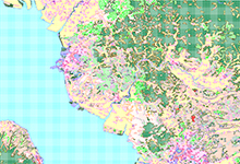
- Land use 1/200000
- Land use classification map (1:200,000). This map is more detailed and colored based on the result of a field survey and results from an aerial photograph.
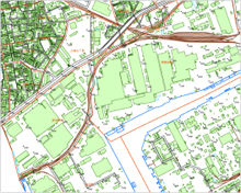
- Topographical map for 1/10000
-
This is a basic map which contains detailed information. We are able to see the details every 2 meters, precisely.
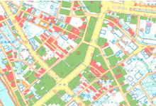
- Basic map
-
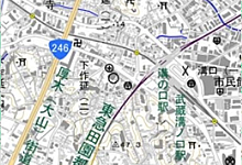
Basic map of the state showing county outlines and all of the information such as buildings, streets, rocks, cliff, This is known as 1/25000
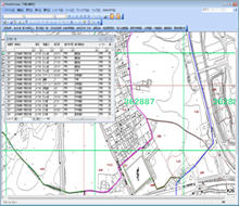
- Different kinds of ledgers
- Ledgers information is different from the basic map information. For example different ledgers need different knowledge about street, rivers clean, black-water, city planning, and fixed assets. In addition, different knowledge is required for each section. We have numbers of great experts, and have rich training sessions.
- Different types of ledgers
- We create different types of ledgers such as streets, rivers, water and sewer services, community parks, public construction and any other designs per your request.