写真測量
Survey Measurement Techniques are improving day by day. Especially the area of aerial photography, mixtures of digital aerial camera, practical implementation of GPS/IMU and image processing technology enable us to photograph prompt, high quality photographs. Compared to Analog photography, application field has been greatly widened.
We combine these two survey measurements and digital photograph images; we applied to measure, research and analysis.
- Aerial photography
- We examine the style of your needs, including vertical photographs, oblique photographs.
Application examples: mapping design, brochures, advertisements,
construction progress reports, comprehend damage situations 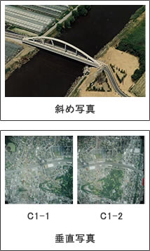
- Digital orthophotos,
-
Aerial photography has slight strains and it is difficult to pile up.
We anticipate your needs and consult with you, we are getting positive feedback.
This technique enables us to obtain GPS points and allows us to pile up with databases.
Compared to aerial photography, it can be applied to more flexible application images.
Application examples: shared databases, landmark asset evaluation,
environmental surveys, photomaps 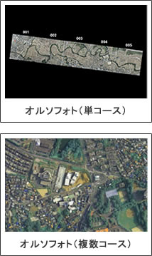
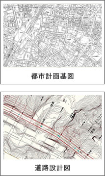
- Digital mapping(DM)
-
Creating a map from numerical data is called digital mapping. We provide data with files depending on your needs. Geographical system, CAD, printing
Application examples: City Planning maps,
road surveys for cadastres,
Water Utility Ledgers